- List of Backups
- View the diff.
- View the diff current.
- View the source.
- Go to Field survey results.
- 1 (2011-03-13 (Sun) 10:43:07)
- 2 (2011-03-13 (Sun) 17:03:12)
- 3 (2011-03-14 (Mon) 19:26:39)
- 4 (2011-03-16 (Wed) 00:17:09)
- 5 (2011-03-16 (Wed) 00:17:09)
- 6 (2011-08-31 (Wed) 15:13:40)
- 7 (2011-08-31 (Wed) 18:27:50)
- 8 (2011-09-02 (Fri) 00:45:50)
- 9 (2011-09-26 (Mon) 12:28:50)
- 10 (2011-09-29 (Thu) 19:45:46)
- 11 (2011-10-04 (Tue) 23:33:13)
- 12 (2011-11-22 (Tue) 13:54:05)
- 13 (2012-01-30 (Mon) 01:28:41)
- 14 (2012-03-30 (Fri) 15:11:20)
- 15 (2012-04-27 (Fri) 08:46:07)
- 16 (2012-08-07 (Tue) 12:41:02)
- 17 (2012-08-07 (Tue) 12:41:34)
- 18 (2012-08-07 (Tue) 16:11:09)
- 19 (2012-10-04 (Thu) 21:37:05)
- 20 (2012-12-29 (Sat) 19:08:58)
- 21 (2012-12-29 (Sat) 19:14:32)
- 22 (2013-01-03 (Thu) 22:13:00)
To be updated.
Results of Tsunami Surveys †
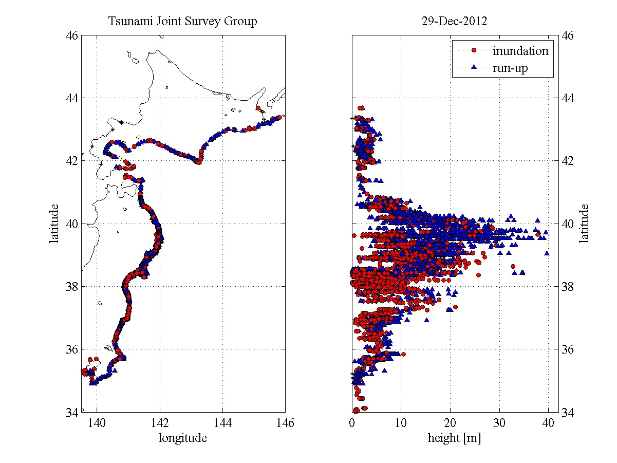
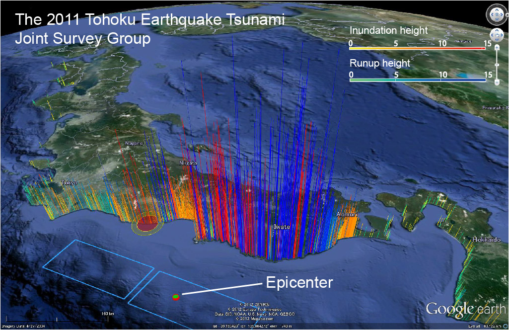
- The following figures show the latest results from all the Japanese Survey Teams. They include data collected from the Japanese Coastal Engineering Committee groups and other data provided by Japanese prefectural and local authorities (figures updated on the 5th July 2011). For more detailed information please refer to the Japanese pages (you need to have installed the fonts for East-Asian characters, and it is then possible to use google chrome to translate the webpage).

The map below was generated using google maps. To access the original files and view them in google earth, please refer to the Japanese pages of this website. If you have the East-Asian characters installed you can follow the following link and download the files http://www.coastal.jp/ttjt/index.php?%E7%8F%BE%E5%9C%B0%E8%AA%BF%E6%9F%BB%E7%B5%90%E6%9E%9C (the relevant files are written in English script so it is quite clear what is to be downloaded).
Official survey data †
Usage and outline †
Data for Google Earth (KMZ file) †
Data in text format for general use †
- Release 20120425
- Readme: Click ->
 +readme_e.txt
 - Data: Click ->
 6as7x
6as7x - Please do not use before Release20120101 due to quality problem
- Readme: Click ->

